 Australia
  Brazil
  China
China  Denmark
  France
  India
India  Indonesia
  Ireland
  Italy
Italy  Malaysia
  New Zealand
  Norway
  Poland
  Saudi Arabia
  Singapore
  South Korea
  Sweden
  Thailand
  United Kingdom
  United States
  Taiwan
  Vietnam
WE WORK ON ALL THE MOBILITY SOLUTIONS OF TODAY AND TOMORROW
With offices in Montreal and Toronto, SYSTRA Canada is part of the SYSTRA Group – one of the world’s leading engineering and consulting groups specializing in transport and mobility solutions. For more than 65 years, our international team has worked alongside cities and regions to contribute to their development by creating, improving and modernizing their transport infrastructures and systems.
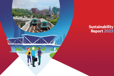
WE ARE COMMITTED TO MORE INNOVATIVE AND SUSTAINABLE MOBILITY, HOW ABOUT YOU?


DEVELOPING MOBILITY SOLUTIONS OF TODAY AND TOMORROW
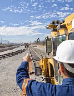
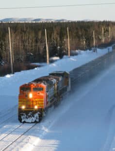
In Canada, SYSTRA's ambition is to be a multi-disciplinary partner, able to respond to all mobility issues. Whether it's energy transition of transportation systems, the development of inter-city railways, the delivery of greenfield and brownfield urban rail, or support for the freight and mining sectors, we tick all the boxes in a rapidly expanding market where the diversity of our expertise is a key asset. We have accumulated some excellent references on Signature projects for the country, which positions us as a solid partner who delivers.
Ambition & Values
GABRIEL, Director, Engineering – Rolling Stock
The work is challenging, interesting, rewarding and varied.
ANTOINETTE, Assistant to the President
This isn't your typical corporate environment – it's a place where respect and collaboration are the heart and soul of everything we do.
CATHERINE, Transport Economist & Asset Management Lead
I love my job, and SYSTRA Canada is a great place to grow!
THOMAS, Eng., Director, Heavy Rail Rolling Stock
SYSTRA Canada has allowed me to learn and work in all these domains allowing me to grow my career.
LUCIE, Marketing Specialist
SYSTRA Canada is the ideal firm for anyone who is motivated and wants to promote excellence and innovation.
JEAN-FRANÇOIS, Eng., Civil Engineer – Transit
The projects in which I participated are varied, both geographically and from infrastructure to studies.
JOIN AN INTERNATIONAL GROUP
SYSTRA offers all its talents a stimulating environment serving the development of sustainable mobility. Come and link your area of expertise to those of more than 10,300 passionate people spread across 5 continents and develop your potential on enriching and diversified assignments.
Why SYSTRA Canada?
CATHERINE, Transport Economist & Asset Management Lead
THOMAS, Eng., Director, Heavy Rail Rolling Stock
LUCIE, Marketing Specialist
JEAN-FRANÇOIS, Eng., Civil Engineer – Transit